Below is additional detail on overlay operations in ArcMap with examples.
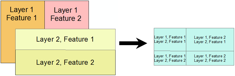
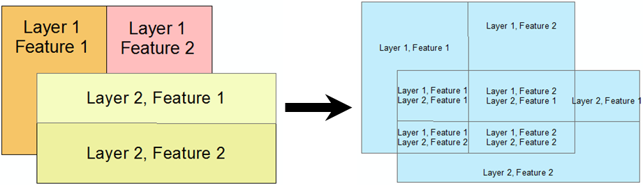
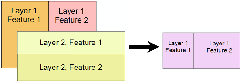
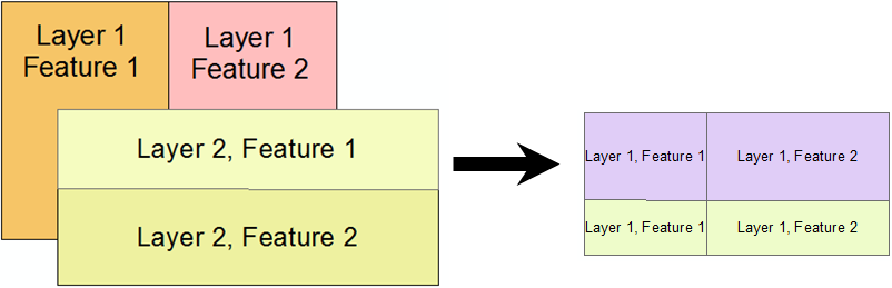
The Intersect tool finds the intersection of features between two or more layers. This tool is used frequently.
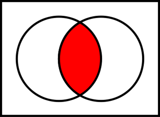
The Intersect Tool maintains the attributes for both intersecting features.
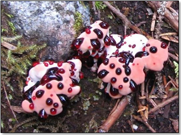
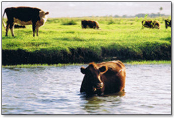
Case Study: Distribution of a Rare Fungal Species
An example of using intersection would be if we wanted to find the habitat for a rare species such as the mushroom shown below. If we know that the species requires requires:
We could now take a layer that contained features of Klamath Mixed Conifer Forests and another that showed the annual precipitation was over 50 inches and intersect the two. The result would be the habitat for the mushroom.
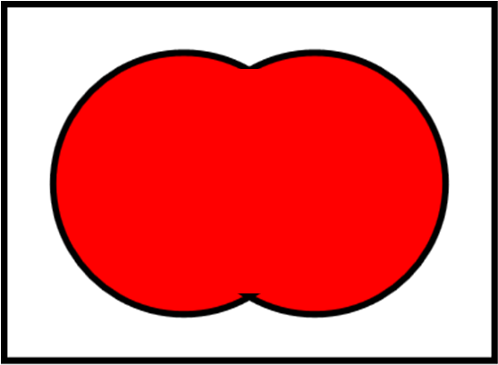
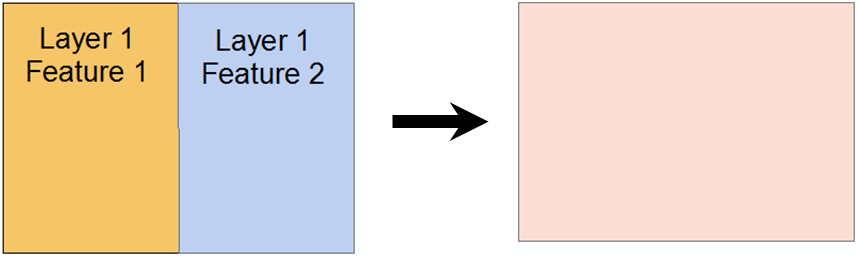
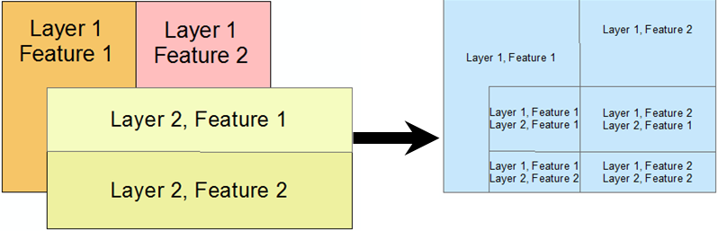
The image below shows a "true" union as you may have learned in geometry.
The Union tool in ArcMap combines the features from one or more layers into a single layer. In other words, it creates the "Union" of two layers, rather than a spatial union as shown above. The resulting features are the unique areas between the two layers. The Union tool in ArcGIS is not used much but is presented here to prevent confusion with the "Dissolve" tool described below.
ArcMap's Union Tool does not perform a Union as shown above, for this you need to use "Dissolve" in the next section.
This tool dissolves features in a layer together, which can be based on a common attribute value or all features together. This is a proper union.
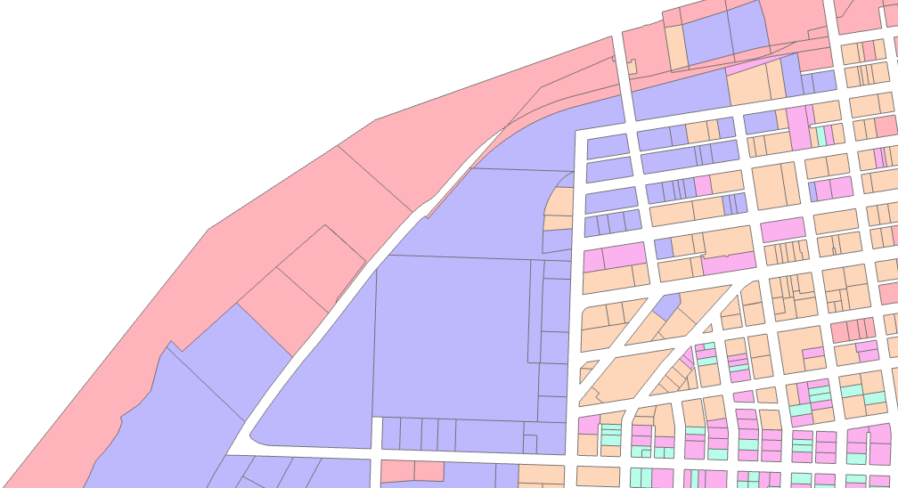
Dissolving is helpful when removing unneeded information, and typically should be executed prior to applying an area based selection. An example of this would be to combine detailed parcel descriptions into general land use categories. Below is an image of the Eureka waterfont that has been symbolized based on general land use such as Commertial, Inductrial, and Residential.
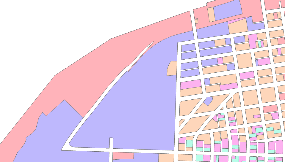
Below is a new dataset where the parcels have been combined (their boundaries "disolved" in Esri terminology) into larger polygons that have the same land use type.
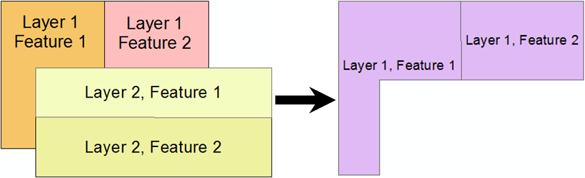
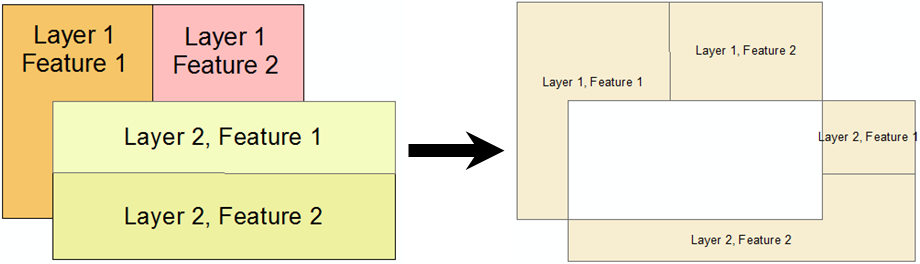
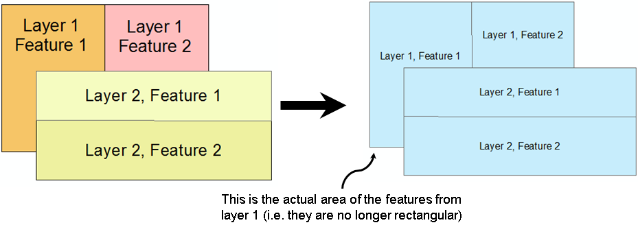
The Clip tool "clips" one layer with all the features from another.
The Clip Tool only maintains the attributes for the original layer.
Clip is commonly used and is closely related to "Intersect". Notice that the only difference is that the attributes are only maintained for the first layer.
The Erase tool uses one layer to "erase" area from another layer.
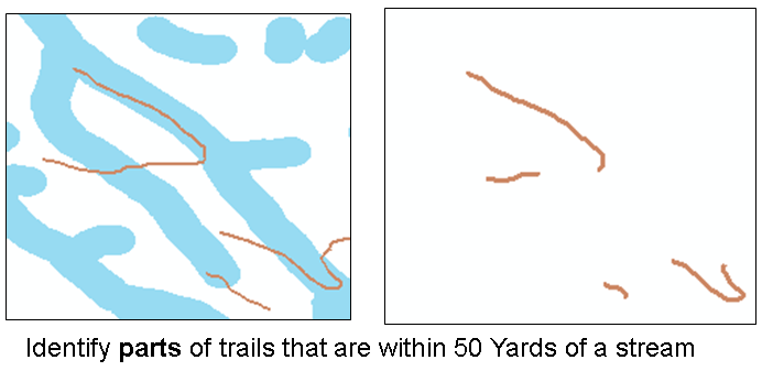
Case Study: Find Legal Grazing Land (Post Ordinance).
An example of "Erase" would be to find grazing land near a stream if you were required to restrict grazing to be at least 100 meters from the stream. You could buffer the stream to 100 meters and then "Erase" the stream buffer layer from the original grazing area layer.
The following tools are used less frequently than those above but come in handy once in a while.
The Split tool "splits" up a layer into multiple layers based on the features in the second layer.
The Identify Tool "identifies" the features in one layer that overlap with features in another layer.
The Symmetric Difference tool finds the area of features that are in one of two layers and not in the other layers.
The Update tool appears to crop the features in one layer to avoid features in another layer:
Both the Append and Merge tools combine vector layers together without changing the spatial data.
© Copyright 2018 HSU - All rights reserved.